10 micro-adventures in France to hike in the mountains
The Covid-19 crisis has revealed to many a need for nature and wide open spaces. The mountain has invited itself into this quest for freedom and micro-adventures in France and close to home have de facto (re)become sources of inspiration and escape. At I-Trekkings, the micro-adventure has always been present even if it is not always called that. Here are 10 micro adventures in France for hiking in the mountains, from the Alps to the Pyrenees via the Jura, the Massif Central and the Pilat. There is something for everyone, for the contemplative, for occasional hikers, for the great sportsmen too. Happy micro-adventure in the mountains!
1 – Nature micro-adventure in the valleys of the Jura
By Foudetrek
Col de Cuvéry, Châtillon en Michaille+ 780 m / – 780 m28 km2 daysTo the south of the Jura massif, the relief softens into an immense plateau, it is the Retord. Its landscape alternates between fir beech groves, immense meadows and cool valleys. The goal of our micro-adventure? Take a bath in nature, simply! The route, in 8, allows you to hide in a thicket a little food and a few beers, for the evening, and to lighten the bag without sacrificing small pleasures. On this May morning, at an altitude of almost 1200 m, the temperature is still cool. The concert of thrushes invades the space, accompanied by a few soloists: black-capped warblers, robins, … We savor the pleasure of walking, of the body moving again.
The fresh air carries the powerful scent of narcissus and the subtle scent of wild roses, while the tender shoots of fir trees exhale sweet vapours, almost the smell of candy. The path penetrates the undergrowth, the eyes take a few moments to acclimatize to the play of shadows and lights. A pond is home to a few tritons, tiny fire-bellied dragons. Around, the traces of deer, wild boar, roe deer and fox are numerous. The lynx and the wolf also roam there and add extra soul to this forest. Coming out of the woods, the immensity of the landscape leaves us speechless. Meadows as far as the eye can see and an incredible panorama of the Alps. We picnic in the grass barely damp with dew. At our feet, orchids, mountain cornflowers and a few subtle southern tulips brighten up the grasslands.
Throughout these two days, we alternate walking and hammock breaks during the warmer hours. Time no longer has a hold and in just two days, the escape is complete.
2 – Micro-adventure, between snow and squalls, in Cézallier
By Minacz
Besse-en-Chandesse+ 2800 m100 km5 daysBased on the desire to rediscover the sensations of an isolated trek in Lapland, a pleasant Auvergne adventure with three friends. Summary and practical information.
Bridging April and May, this hike begins in Besse-en-Chandesse. Low sky, snow, wind... Not ideal, but we were warned, having followed the weather forecast at the time. Final destination ? Le Lioran, from which we will have to return by train to Paris. The main objective? Take advantage of the peaceful Cézallier, volcanic massif known for its low population density, its mountain weather and its varied landscapes, between volcanic cones, plateaus, bogs and worn glacial cirques. As the arrival in Besse is late after a Clermont getaway, we must bivouac shortly. Head for Lac Pavin then a superb stage between the maar and the isolated village of La Godivelle. That evening, we settled in a wood away from the GR, to take shelter. Because in the meantime, a brief deluge surprised us: between the gusts and the snow, it was no longer possible to see 10 meters away. Impressive.
Detour, storm and return.
After a snowy sleep, we set off for Lugarde and, theoretically, the next day, the Col de Serre (located under the Puy Mary) then, finally, the Super-Lioran station. Alas, after another stage flirting with Corrèze, the weather changed our plans. This time, a squall promises us, within 48 hours, snow and storms...
In forced march despite the headwind, we accelerate towards Dienne, with the hope of reaching the municipal lodge. GPS that gets lost there, detours as the storm approaches... 10 terminals later, a resident of a hamlet kindly drops us off at Dienne where, behind the windows of our overnight stay, we will see brutal storms s fall on the heights… The next day, caught up in time, we walk to Murat and the end of our adventure. The following ? A train to Lioran, two trains to return to Paris and lots of memories. Despite the frustration of not having come full circle and the desire to come back.
3 – Micro adventure for all in Vanoise
By gregoutdoor
Beaupraz+ 1170 m / -1170 m21 km2 days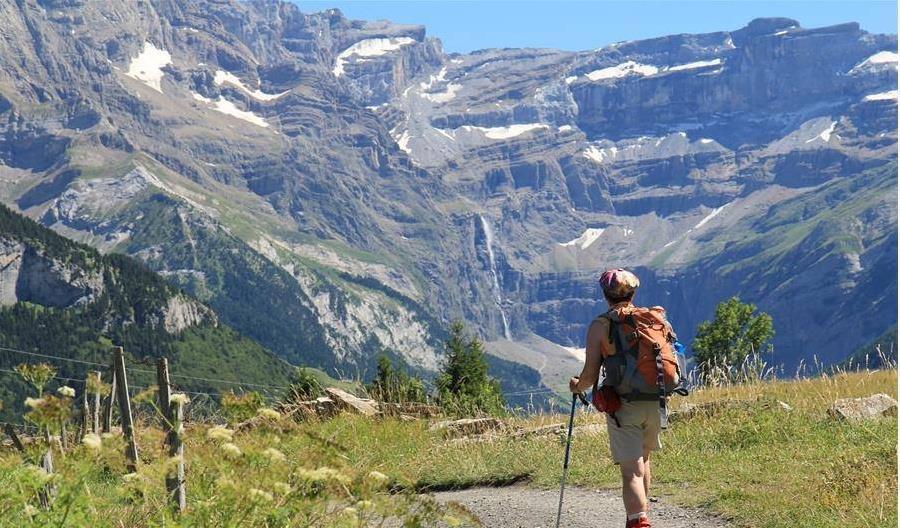
The Vanoise National Park is a paradise for hikers. The tour of the Lanchettes ridge is a micro-adventure accessible to all depending on the starting point. If you have a little hiking experience, I advise you to start from Beaupraz and climb to the Col de la Chal (2465 m) via the Combe du Barmail. It's steep at the start but if you go in the cool like me, you won't be too hot and as it's quite steep, it's in the shade in the morning. When you arrive at the Lavachet chalet, the landscape opens up and the mountains reveal their natural setting. The slope is also greatly softened. Further on, pass by the Lac des Moutons (2574 m) with the added bonus of a beautiful panorama of Mont-Blanc a little before. All that remains is to reach the Mont Pourri refuge (2370 m). Normally, it's pretty quick. Except that there are a lot of marmots in the area... And inevitably, we hang out a little more on the path, we take the time to observe the marmots.
The refuge is really nice and it has a beautiful view of the Grande Motte glacier. To join it, if you are walking with young children, it is also possible to leave from the Transarc gondola to really make this micro-adventure, an adventure for everyone.
The next day, leisurely descent to the starting point in Beaupraz.
Read the story and download the GPS track of this hiking weekend in Vanoise.
4 – Micro-adventure at the door of the house: around Lake Annecy
By kosmikrider
Annecy-le-Vieux+ 4750 m92 km3 daysSo many wonders from the house!
With a start near my home, on the shores of Lake Annecy, the GRP begins in its city part with an early 20th century architecture in Annecy-le-vieux. The route then passes along the edge of the superb medieval old town of Annecy before continuing into the Semnoz forest, where it continues to climb over 1200m of drop to reach its summit. Many views of the lake from the trail, then apotheosis on Mont Blanc once at the top! This is followed by the descent to the Col de Léchaux, the site of the first bivouac.
The trek continues in its part of the Massif des Bauges between climbs and descents with bucolic scenery before descending completely to the altitude of the lake where supplies are possible in Doussard, and where swimming in the Bout du lac reserve imposes itself. The transition to the foothills of the steep Aravis massif is clearly visible, the path then climbs full throttle to the Col de la Forclaz, place of the second bivouac.
Third day of rather hilly hiking up to the Col de Bluffy, then a steep climb to Mont Veyrier accompanied by the storm. I will bypass the last part of its summit because I know that its ridge is very slippery, to finally go down in the mud to the lake and go home for a good shower!
Read the story and download the GPS track of the Tour du lac d'Annecy.
5 – Micro-adventure and bivouac in the Pilat massif
By gregoutdoor
Collet de Doizieux+ 1305 m26.5 km2 daysThere are excellent opportunities to get bargains or even very good bargains during this sales period (January 12 to February 8, 2022). In order not to give in to the unreasonable temptations of the sales, here are some rules to follow to buy responsibly:
Here are some offers from our partners:
As soon as the confinement eased at the time of the Covid-19 health crisis and the 100 km radius set up by the State allowed me to leave my home, I had the need to go for a walk and it was in the Pilat massif that I went with my tent. There was no question of doing a sporty hike, quite the contrary. The idea was rather to reconnect with nature, to smell the scents of plants, to touch the trunks of trees, to feel alive again.
So off I went towards the Collet de Doizieux, my starting point for a two-day walk on the crests of Pilat. I sink into the forest. it is steep, very steep even at the start of the path. The calves burn. Then the slope softens, the Crêt de l'Oeillon (1364 m) is in sight. This is the highest peak of this first stage. I take the time to walk and stop regularly. I need to be in symbiosis with my environment. The profile of the stage is then rather descending and joins the Saint-Sabin chapel. From here, the panorama embraces the Rhone Valley. On a clear day, you can even see the Alps. Not today unfortunately. The weather is nice but it is slightly foggy above the Rhone Valley.
I end up setting up my bivouac away from the trail in the middle of the forest. Again, I needed to be isolated, alone, in the middle of nature. Good, and then the wind didn't make me want to climb the ridges. This bivouac was not the most beautiful that I could do but each gesture was experienced as a real deliverance: pitching the tent, fetching water, cooking the freeze-dried, inflating the mattress, entering the bag of sleeping. I have a fairly precise memory of each of his moments.
The next day, I climbed to the Crêt de la Perdrix (1432 m), the highest point of the Pilat massif. I took in the landscape with a long, languorous gaze. I even saw Mont Blanc in the distance. Then, I started my descent to the medieval village of Doizieux.
Read the full story and download the GPS track of the 2-day hike on the Pilat crests.
6 – Micro-adventure in the Vanoise National Park
By Manael
The Bows => Pralognan la Vanoise+ 5550 m95 km7 daysThe Vanoise in Savoie is a favorite land for hiking. I did a traveling week during the summer from Les Arcs resort (above Bourg-Saint-Maurice) to the village Pralognan-la-Vanoise, between alpine passes and glacial valleys, from North to South . The Vanoise National Park is crossed by the GR5 and its GR55 variant, which allow you to explore up and down two major valleys of the massif: the Maurienne and the Tarentaise. On my route, you have to ride different passes: Plan Séry pass (2609 m), Palet pass (2652 m), Leisse pass (2761 m) and Aussois pass (2916 m).
Each year, a traveling circus troupe criss-crosses the paths and stops in the refuges for a show of songs, music, acrobatics and funny stories! This spicy side of the Vanoise is nothing without the warm welcome of the refuge guards and the Savoyard gastronomy. The alpine landscape is also to be savored with the eyes with the altitude lakes: Lac de la Plagne (2144 m), Lac de Tignes (2100 m), Lac de la Leisse (2500 m), Lac Blanc (2285 m) and the Upstream plan (2078 m).
Not to mention a formidable mountainous belt with its largest ice cap in Europe and its prestigious peaks over 3000: Bellecôte, Grande Motte, Grande Casse, Grand Bec, Dent Parrachée, Pointe de the Observatory and, in the distance, the border peaks of the Italian Alps.
Sometimes we go back in time to a distant era when mountain life dominated the valleys and prioritized places of prayer with its small high-altitude chapels. The alpine lawns, the vast mountain pastures, the steep gorges and the mineral atmosphere of my crossing of the Vanoise make it an essential destination for roaming and a land of incredible adventures!
Read the full story and download the GPS track of the Crossing of the Vanoise by Manael
7 – Micro-adventure in the Bauges
By Mylka74
Ash Pass => Notre-Dame de Bellevaux car park (Ecole-en-Bauges)+ 1680 m23 km2 daysA micro-adventure just a stone's throw from Chambéry, would you like it? I left for a weekend to discover this wild and preserved massif that is the Bauges massif. The little extra: the ascent of two peaks among the 14 peaks over 2000 meters in this massif. Dropping off a car at the point of arrival is the only condition for taking a nice route.
So I start the first day from the Col du Frêne for the ascent of the Dent d’Arclusaz (2041 m). An evolution in the forest on most of the route, which ends in cabled passages. Once the summit is reached, I begin the descent via the southern ridge (aerial) which joins the eponymous pass. Then, I evolve in a wide valley to finish at 1500 m near the chalet de Bottier, the ideal altitude to bivouac under the stars at this time!
The goal for the next day? Mont Pécloz (2197 m), which I will reach by heading towards Mont d'Arménaz. The route from the pass between these two peaks is steep and steep, but without difficulty. I then join the car (previously dropped off) by the only marked path that descends from Mont Pécloz due west.
Two days of walking away from the crowds with beautiful elevation changes, reserved for seasoned hikers.
8 – Micro-adventure on the high plateaus of Chartreuse by trail
By Auriandig
Chambery station => Gare de Grenoble+ 3872 m / -3832 m66 km1 day1 year just after my tour of Chartreuse in 3 days, in the company of Rudi, I decided to set myself the challenge of crossing the Hauts Plateaux de Chartreuse on 1 day from Chambery station to Grenoble station.
I'm taking advantage of Whit Monday and the predicted weather to embark on this long crossing next to the house. Departure at 6 a.m. from Chambéry station with the GR9 as the main common thread, the first 20 kilometers to the Alpette pass pass without problem. The highlands are far from calm, deconfinement obliges, an impressive number of hikers roam the trails. The landscapes remain breathtaking and I take advantage of my lunch break around 12:30 p.m. at the Col de Bellefond for a few tens of minutes of contemplation. Then it's off again towards the Trou du Glaz before joining a rather trying and uninteresting part between the Col du Coq and the Fort du St Eynard. Everything is happening under cover and my left knee is starting to seriously handicap me. I'm more into walking fast than running. I arrive somehow at the fort but after an apple and sandwich break, it starts to go much better. I have less than 10 km left and a little over 300 m of elevation gain to finish. So I end up going down the Bastille and out through the Porte de France to run to Grenoble station a little before 7 p.m. after a little less than 1 p.m. of effort. I just have time to jump on the train to Chambéry and on the way back see all the landscapes of this very long post-confinement day scroll through the window.
9 – Micro-adventure in bivouac in the Cerces
By gregoutdoor
Refuge Laval+ 2730 m / -2730 m36 km3 daysThe Cerces massif, located in the Hautes-Alpes, is one of the most beautiful in the Alps. So here I am on my way to the Laval refuge on the heights of the Clarée valley. We leave the car there and embark on our first day of walking towards the Drayères refuge via the Béraudes lake. It's autumn, it's sunny and there's no one on the roads. We meet a hiker during the day and two guys at the Drayères refuge. At this time of year, the refuge is open in winter mode: no caretaker, no kitchen. We have access to the dormitories and the dining room and the unequipped kitchen.
The next day, we take the direction of Mount Tabor without pushing as far as it because I am not in good shape. At the Col des Muandes (2,828 m), we branch off towards Lake Lavoir where we will set up the bivouac not very far. I like having the mountain all to myself. It's a bit selfish but it's always when I have the best feeling. It is not hot at this time and we go quickly after dinner in the tent.
In the morning, the tent canvas is frosty. We are waiting for the sun to fold everything up and get back on the road. This third day is also a nice slap on the panorama side. We pass two passes during the day, that of the Vallon (2645 m) then the Grand Cros (2835 m). Descent via the Guardioles lakes before ending the loop at the parking lot of the Laval refuge. A great hiking weekend!
Read the full story and download the GPS track of the Cerces tour.
10 – Micro adventure in the Néouvielle massif
By ClementM
Tournaboup car park+ 2275 m / – 2275 m23 km3 daysWant to clear your head over a long weekend, here is a beautiful three-day hike that feels good. Direction the Néouvielle nature reserve in the Hautes-Pyrénées for a loop in the middle of lakes and mountains.
This affordable trek allows you to discover the beautiful world of roaming and bivouacs without any particular difficulty. The most athletic can enhance it with a beautiful 3000, the Pic de Néouvielle, and the bravest can swim in clear, fresh water.
You can access the start from the Grand Tourmalet station on the Barèges side, where it is possible to spend the night the day before departure. Then the route alternates between busy paths and other more intimate ones where you will surely encounter cows and sheep roaming free. For a first experience don't worry you will never be really alone. For the more solitary avoid periods of high attendance.
For our part, this micro-adventure allowed us to spend our first nights in a bivouac and to be independent for three days. Despite heavier bags than usual and cold nights, this hike motivated us for greater adventure. Leaving?
Read the full story and download the GPS track of the 3-day bivouac hike in Néouvieille.
Bonus: Bivouacs on the Forez stubble
By Foudetrek
Col du Béal, Saint-Pierre-la-Bourlhonne+ 1191 m / – 1191 m49 km3 daysWe are at golden hour. The tent is discreetly planted for our first bivouac on the stubble of Forez. The stubbles are these natural meadows dotted with heather, blueberry trees and a few isolated pines and birches. A few steps from us, a peat bog from which springs a spring. I fill it with enough to rehydrate the evening meals and prepare breakfast the next day. At more than 1500m above sea level, my gaze embraces the immensity of this central massif plateau at sunset. Beyond, the chain of puys takes shape in the mists. When I settle into my sleeping bag, I hear the last trills of skylarks and pipits which are gradually replaced by the song of a little owl…
Third and last day of our hike, we break camp under the roar of an unexpected storm. 6:30 a.m., the sky is ablaze with blue-purple and orange hues. Our path today leaves the stubble fields for a forest return to our starting point, the Col du Béal. Past the Fossat cross, the path plunges into a wild eponymous valley and runs along a stream. We are moving through a beautiful forest. Old dead trunks bear huge saprophytic fungi. Traces of woodpeckers, squirrels, field mice are countless. Gradually we regain altitude and with the reappearance of stubble our journey ends.
Did you like my article? Give it 5 stars
Click on a star to rate it
Average rating 5 / 5. Number of votes: 10
No votes yet. Be the first to rate my post.
I'm sorry this article was not helpful to you!
Let me improve this article!
Tell me how I can improve this article
THE ARTICLE HAS YOU MORE? SHARE IT!


